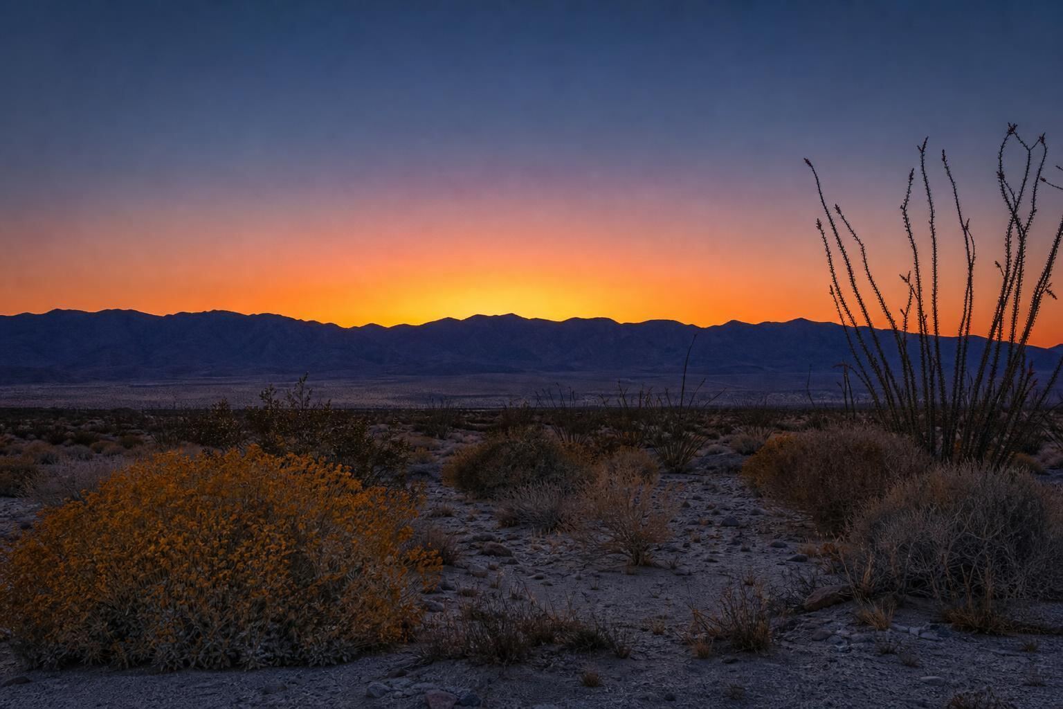
California's largest state park — 650,000 acres of desert, canyon, and sky.
History
Named for the Spanish explorer Juan Bautista de Anza (who led an overland expedition from Sonora to San Francisco through here in 1774–1776) and the Spanish word borrego (bighorn sheep). The Kumeyaay and Cahuilla peoples lived in this desert for thousands of years; you can still find bedrock morteros (grinding holes), pictographs, and trail markers throughout the park. In the 1800s the Butterfield Overland Stage crossed the park en route from Missouri to San Francisco. The land was assembled into a state park starting in 1933 and reached its current 650,000-acre size through decades of expansion.
Geography and geology
The park spans from just below sea level near the Salton Sink up to over 6,000 feet at Combs Peak. The Peninsular Range runs along the western edge; the Santa Rosa Mountains rise sharply to the north. The San Jacinto and Elsinore fault zones cut through the park — the Borrego valley is a pull-apart basin created by their motion. The badlands south and east of town are eroded Pliocene sediments, some of which contain marine fossils from when this was all under the Gulf of California.
Wildlife
Peninsular bighorn sheep (federally endangered, ~800 in the park) are the icon — most likely seen at dawn in Coyote Canyon or on the ridges above Palm Canyon. Coyotes, kit foxes, bobcats, mule deer, roadrunners, chuckwalla lizards, desert tortoises, rattlesnakes (mostly Speckled and Red Diamond), and hundreds of bird species. Give bighorn 100+ yards; never approach any wildlife. Watch for tortoises crossing dirt roads March–May.
Wildflowers
In a superbloom year (once every 5–10 years, most recently 2017 and 2019), the desert floor becomes a carpet of yellow desert dandelion, purple sand verbena, orange California poppy, and magenta beavertail cactus. Even in an average year, February through late March brings desert lilies, primrose, chuparosa, and ocotillo blooms. Best spots: Coyote Canyon Road, Henderson Canyon Road, DiGiorgio Road, the washes off Borrego Springs Road, and Anza-Borrego Foundation's wildflower hotline (760-767-4684) updates weekly in season.
Slot canyons and palm oases
The Slot, Calcite slot, and Sandstone Canyon are the accessible slots. Palm Canyon, Mountain Palm Springs, Torote Canyon, Sheep Canyon, Indian Gorge, and Bow Willow are the best palm oases. The California fan palm (Washingtonia filifera) is the only palm native to California and only grows near desert springs. See the hiking guide for details.
Scenic drives
Montezuma Grade (S22) — the paved climb from town to Ranchita, 4,000 feet of gain, extraordinary views. Erosion Road — 18 miles of graded dirt through the badlands with numbered geology stops. Yaqui Pass (S3) — the paved connector south, with pullouts. The drive to Font's Point — 4 miles of dirt to one of the great sunset overlooks in California. All doable in a passenger car except Font's Point (high-clearance recommended).
Visitor centers and ranger programs
The main visitor center is a mile west of Christmas Circle — set into a hillside, with interpretive exhibits, a bookstore, restrooms, and a ranger desk. Open 7 days a week, 9 a.m.–5 p.m., October 1 through May 31. Summer hours (June 1 through September 30) are Friday, Saturday, and Sunday only, 9 a.m.–5 p.m. Ranger-led wildflower walks, geology hikes, and night-sky programs run November through April — free or $10–20. Book at the center or on parks.ca.gov.
Camping
Borrego Palm Canyon Campground
120 sites, full hookups available. Adjacent to the Palm Canyon trailhead. Reserve on reservecalifornia.com — books out 6 months ahead for peak weekends.
Tamarisk Grove
27 sites in a shady tamarisk grove. Popular with families. Reserve ahead in season.
Culp Valley Primitive Campground
Free, first-come-first-served, up on the Montezuma Grade at 3,400 feet. Cool nights even in summer.
Dispersed camping
Free and legal on most dirt roads inside the park. You need a fire pan (no ground fires), pack-out waste, and self-sufficiency. Rockhouse Rd, Blair Valley, and Fish Creek Wash are all classic dispersed spots.
Photography
See the photography guide. Golden hour on the badlands, blue hour on the palms, Milky Way anywhere. Font's Point at sunset is the icon.
Safety and best seasons
Cool season (October–April) is the safe window. Summer requires serious desert experience — 105–120°F daily. Always carry more water than you think you need, tell someone your plans, and download offline maps. Cell service ends fast in the park. A satellite messenger is worth carrying if you're heading anywhere remote.
Cultural sites and respect
The park contains hundreds of documented Kumeyaay and Cahuilla cultural sites — pictographs, morteros, sleeping circles, trail shrines. Look, photograph, don't touch, don't rearrange stones, don't camp on obvious cultural ground. Many sites are unmarked to protect them.
Frequently asked questions
Is there an entry fee?
Only at the developed campgrounds and at Palm Canyon day-use ($10, self-pay). The rest of the park is free to enter.
Can I drive my rental car in?
Yes — most pavement and graded dirt is fine. Read your rental agreement's off-pavement clause before venturing far.
What's the difference between the park and the town?
The town of Borrego Springs is a private enclave completely surrounded by the state park. You are always in Anza-Borrego.
Are drones allowed?
No — drones are prohibited in all California state parks. You can fly on nearby BLM land and in Ocotillo Wells SVRA.
Can I hunt or collect artifacts?
No. No hunting, no artifact collection, no rockhounding inside the state park boundary.
Where do I check current road closures?
Visitor center or 760-767-4205. Coyote Canyon Road is closed beyond the Third Crossing (storm damage since Aug 2023) and the lower stretch also closes each spring for bighorn lambing.
Stay the night
Moonlight Oasis is a 3-bedroom dark-sky residence in Borrego Springs. Sleeps 13.
Check availability →Keep reading
The Ultimate Guide to Borrego Springs Restaurants & Food
A no-stoplight town with a surprisingly good food scene.
The Ultimate Hiking Guide to Borrego Springs
Palm oases, slot canyons, badlands, and 500+ miles of trail in one state park.
The Complete Stargazing Guide to Borrego Springs
Borrego Springs is one of only two International Dark Sky Communities in California.
The Ultimate Off-Roading Guide to Borrego Springs
Anza-Borrego is one of the most open off-road parks in California.