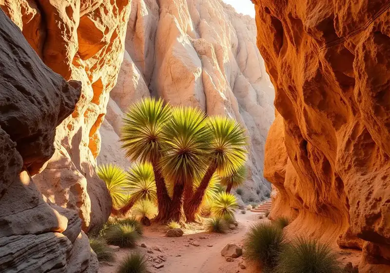
Palm oases, slot canyons, badlands, and 500+ miles of trail in one state park.
Before you go
Hike at dawn or during the last two hours of daylight from May through September — daytime temperatures regularly hit 105°F+ and pavement can reach 140°F. Even in cool months, always carry at least one liter of water per person per hour. Cell service is spotty in town and nonexistent in most of the park — download offline maps in Gaia GPS, AllTrails, or CalTopo before you leave the house. Tell someone your route and expected return. A Garmin inReach or Zoleo satellite messenger is genuinely worth having if you plan to hike alone or off the main trails. The visitor center posts current trail conditions and closures — worth a five-minute stop on your first morning.
Easy hikes (1–3 miles, mostly flat)
Palm Canyon Trail
3 miles round trip, 500 feet of gain. Borrego's signature hike — a boulder-filled canyon that opens onto the largest native California fan palm oasis in the state (600+ trees). Trailhead is 10 minutes from town, $10 day-use fee. Best at sunrise or the last hour of daylight. Do not attempt in the middle of a summer day.
Elephant Trees Discovery Trail
1.5 miles round trip, flat. A short interpretive loop through one of the only elephant tree stands in California — a rare, aromatic species related to frankincense. Read the trailhead sign before you go.
The Slot (upper section)
0.5 miles into the canyon and back — 30 minutes total. Descend a sandy ramp into a narrow curving sandstone slot. Kids love it. The upper section is easy; keep going and it turns into a proper adventure (see moderate).
Borrego Palm Canyon Nature Loop
0.5 miles, stroller-friendly. Interpretive signs on desert ecology at the campground.
Cactus Loop Trail
1 mile, flat. Off Yaqui Pass. A quiet, less-visited walk through cholla, barrel, and beavertail cactus.
Kenyon Overlook
1 mile, mostly flat. Easy sunset walk to a ridge with a big view of the valley.
Yaqui Well Nature Trail
1.6 miles round trip. Follows a wash to a natural spring — good bird-watching, especially at dawn.
Panoramic Overlook
0.5 miles up from Borrego Palm Canyon Campground. The classic sunrise walk — the eastern sun hits the entire valley in one wide sweep.
Moderate hikes (3–6 miles)
The Slot (full length)
2 miles round trip. A proper slot canyon with one narrow squeeze and some low scrambling. Best in cool months; check forecast for rain — never enter a slot with any storm within 50 miles.
Hellhole Canyon to Maidenhair Falls
5.5 miles round trip, 900 feet of gain. A seasonal waterfall inside a palm-shaded canyon. Best January through late March when the falls are flowing. Trailhead is a mile past the visitor center.
Calcite Mine
4 miles round trip, some scrambling on the return. Old WWII-era optical calcite mine (used in bomber scopes) with jaw-dropping badlands views. Access via a rough dirt road — high clearance recommended.
Ghost Mountain / Marshal South Home
2 miles round trip, 800 feet of gain. A steep push up to the stone ruins of Marshal South's 1930s desert homestead. Read The Ghost Mountain Chronicles first — the hike is 10x better.
Wind Caves (via Fish Creek)
1 mile round trip after a long dirt drive in. Wind-eroded sandstone formations you can crawl into. Great with kids. The drive is half the adventure.
Pictograph Trail / Smuggler Canyon
2 miles round trip to Kumeyaay pictographs; extend to a dry-fall overlook of the Vallecito Valley. Route-finding on the last quarter mile.
Mountain Palm Springs Loop
3 miles round trip visiting six separate palm groves in one loop. Remote trailhead in the south end of the park — a full half-day with the drive.
Difficult hikes (6+ miles or serious elevation)
Villager Peak
13 miles round trip, 5,000 feet of gain. A quiet, brutal ridge hike into the Santa Rosa Mountains from Clark Dry Lake. For experienced desert hikers only — no water on route, exposed the entire way. Best November through February, dawn start.
Rockhouse Canyon
10+ miles, minimal shade, long, loose. Multi-hour approach on a rough road just to reach the trailhead. Historic stone rockhouses at the end.
Coyote Mountain
6 miles round trip, 3,000 feet of gain, off-trail scramble. Route-finding required to the summit above town. Extraordinary views of the entire Borrego valley.
Rabbit Peak
22 miles round trip, 7,600 feet of gain — often called one of the hardest day hikes in Southern California. Do not attempt without backcountry desert experience.
Whale Peak
5 miles, 1,700 feet of gain from Blair Valley. Route-finding, cross-country, big summit view. A cult favorite among desert peakbaggers.
Slot canyons in depth
Anza-Borrego has more than a dozen slot canyons. The Slot is the classic, easiest to access, and busiest. Calcite slot, near the Calcite Mine, is shorter but more dramatic and much quieter. Sandstone Canyon (drive-through) is a narrow twisting sandstone corridor in Fish Creek Wash. The Domelands near Split Mountain have several unnamed slots that reward exploration. Rule number one: never enter any slot canyon with rain in the forecast within 50 miles. Flash floods here arrive from storms you cannot see or hear. Watch the sky, watch the wash — turn around if you see debris flowing.
Palm oases — a complete list
There are more than 25 native palm oases in the park. The main ones: Borrego Palm Canyon (largest, easiest, 600+ trees), Mountain Palm Springs (six groves in one loop), Torote Canyon, Sheep Canyon, Cougar Canyon, Indian Gorge, and Bow Willow. All require a hike; most require a drive on rough dirt. The California fan palm (Washingtonia filifera) is the only palm native to California and only grows near desert springs.
Sunrise, sunset, wildflower, and winter hikes
Best sunrise walks: Panoramic Overlook, Kenyon Overlook, Peg Leg Smith Monument, and the top of Coyote Canyon Road. Best sunset walks: Font's Point (drive in, walk the rim), the Slot rim, and the sculpture fields at Galleta Meadows. Wildflower hikes: anywhere in Coyote Canyon, DiGiorgio Road washes, or Henderson Canyon Road from mid-February through late March in a decent bloom year. Winter is peak season — everything is a winter hike here. December through February brings crisp 65–75°F afternoons and 40°F mornings.
Hiking with dogs and kids
Most state park trails prohibit dogs — Palm Canyon, the Slot, Hellhole, and every named trail. Dogs are allowed on paved roads, dirt roads, and in the campgrounds. Coyote Canyon Road and nearby BLM land are the dog-friendly options. For kids: Palm Canyon (short, adventurous), the upper Slot (crawl-through fun), Elephant Trees (short interpretive), Wind Caves (climb-inside sandstone), and the Nature Loop at the campground. Bring more water and snacks than you think for kids — the dry air burns through both.
Packing list — day hike
Sun hat with a brim, polarized sunglasses, SPF 50 sunscreen, lip balm with SPF, a buff or bandana, three liters of water per person for a half-day hike, electrolyte tabs (Nuun or LMNT), 300+ calories of snacks per hour, an offline map (Gaia, AllTrails Pro, or CalTopo), a paper backup map, headlamp with fresh batteries even for a day hike, small first aid kit with tweezers for cactus spines, hiking poles for longer descents, and a wind layer for winter mornings. In summer: a wet buff for your neck, ice water in an insulated bladder, and a much earlier start time.
Desert safety — the honest version
Heatstroke is the real danger April through October. Symptoms come fast: headache, nausea, stopped sweating, confusion. Stop, get shade, cool the neck and armpits with water. Rattlesnakes are around all year but active March through October — watch where you put hands and feet on rocky sections, give them a wide berth and they leave you alone. Kissing bugs, scorpions, and centipedes exist but are almost never a problem for hikers. Flash floods can arrive in washes and slots from storms 50 miles away — check the entire regional forecast, not just Borrego. Cell service ends fast — carry a satellite messenger for anything remote.
Ranger programs and guided hikes
The Anza-Borrego Foundation and state park rangers run guided wildflower walks, geology hikes, and night-sky walks from November through April — usually free or $10–20. Schedule is posted at the visitor center and on parks.ca.gov. Book the wildflower walks a few days out in February and March.
Frequently asked questions
Do I need a park pass?
Anza-Borrego is free to enter except at the developed campgrounds and at Palm Canyon day-use ($10, self-pay iron ranger at the trailhead). Fine to park anywhere on the shoulder of dirt roads.
When is it too hot to hike?
Mid-May through late September, daytime hiking is genuinely dangerous. Sunrise hikes only (up by 5 a.m., done by 8), and short ones. Most locals stop hiking at 8 a.m. from June through August.
Are rattlesnakes a real concern?
Yes but manageable. Watch where you put your hands and feet, especially on rocky sections in warm months. Give them room and they'll leave you alone. Bites are rare and hospitals in Indio and El Centro carry antivenom.
Which hike should we do first?
Palm Canyon at sunrise — 3 miles, iconic, and gives you a proper feel for the park in under two hours.
Is there anywhere with running water?
Palm Canyon trailhead and the developed campgrounds. Nowhere else. Carry all your water.
Can I hike at night?
Yes, and it's magical. Bring a headlamp with a red-light mode, stay on well-known trails, and watch for snakes crossing warm sand.
Stay the night
Moonlight Oasis is a 3-bedroom dark-sky residence in Borrego Springs. Sleeps 13.
Check availability →Keep reading
The Ultimate Guide to Borrego Springs Restaurants & Food
A no-stoplight town with a surprisingly good food scene.
The Complete Stargazing Guide to Borrego Springs
Borrego Springs is one of only two International Dark Sky Communities in California.
The Ultimate Off-Roading Guide to Borrego Springs
Anza-Borrego is one of the most open off-road parks in California.
Things to Do in Borrego Springs (Complete Guide)
Beyond the stars and the hikes — the full menu.